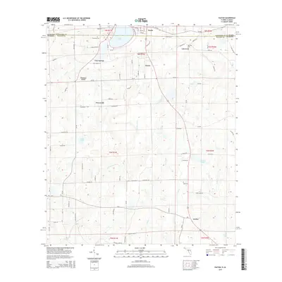
2015 Map of Paxton
USGS Topo · Published 2015About this map
Lake Jackson straddles the state line in this corner of the South, serving as a focal point for the bordering communities of Florala in Alabama and Paxton in Florida. This landscape is defined by the subtle rise of Britton Hill and the intricate drainage of the Pine Log Cr system, including its eastern and western branches. The map details a network of rural settlements and family landmarks, from Lakewood to Flowersville, connected by a grid of county roads and historic routes like State Line Rd.
Find a feature on this map
90 named features on this map. Tap any name to fly to it.
Don’t see what you’re looking for? This feature index may not catch every label — zoom into the map to look around manually.
Map Details
Editions of this 2015 Paxton Map
This is the sole edition of this map. No revisions or reprints were ever made.
Other maps of this area

1949 · Glendale
USGS Topo · 1:62,500

1949 · Laurel Hill
USGS Topo · 1:62,500

1950 · Laurel Hill
USGS Topo · 1:62,500

1951 · Glendale
USGS Topo · 1:62,500

1953 · Andalusia
USGS Topo · 1:250,000

1957 · Andalusia
USGS Topo · 1:250,000

1957 · Pensacola
USGS Topo · 1:250,000

1959 · Pensacola
USGS Topo · 1:250,000

1960 · Pensacola
USGS Topo · 1:250,000
1969 · Hacoda
USGS Topo · 1:24,000