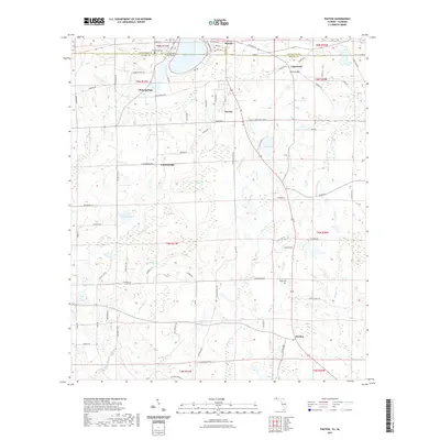
2021 Map of Paxton
USGS Topo · Published 2021About this map
Lake Jackson straddles the state line between Alabama and Florida, serving as a prominent geographical anchor for the communities of Florala and Paxton. This landscape is defined by the subtle shift from the rolling hills of Covington County into the flatwoods of Walton County, documented here as it appeared in the early 2020s. The map captures a high degree of local detail for genealogists and land researchers, including family-named landmarks such as Britton Hill and historical burial sites like Greenwood Cem and Miller Cem.
Find a feature on this map
92 named features on this map. Tap any name to fly to it.
Don’t see what you’re looking for? This feature index may not catch every label — zoom into the map to look around manually.
Map Details
Editions of this 2021 Paxton Map
This is the sole edition of this map. No revisions or reprints were ever made.
Other maps of this area

1949 · Glendale
USGS Topo · 1:62,500

1949 · Laurel Hill
USGS Topo · 1:62,500

1950 · Laurel Hill
USGS Topo · 1:62,500

1951 · Glendale
USGS Topo · 1:62,500

1953 · Andalusia
USGS Topo · 1:250,000

1957 · Andalusia
USGS Topo · 1:250,000

1957 · Pensacola
USGS Topo · 1:250,000

1959 · Pensacola
USGS Topo · 1:250,000

1960 · Pensacola
USGS Topo · 1:250,000
1969 · Hacoda
USGS Topo · 1:24,000