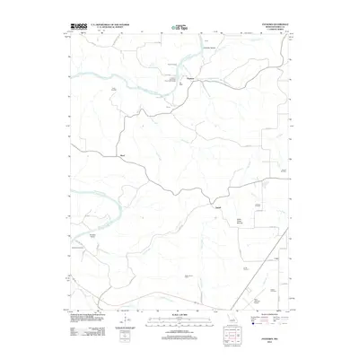
2012 Map of Paydown
USGS Topo · Published 2012About this map
The Gasconade River winds through this section of Maries County, defining a landscape of deep valleys and river bends. Small rural settlements like Paydown, Bend, and Lindell anchor the high ground between numerous creek drainages. Cultural and archaeological markers are prominent here, including Indian Paintings near the river and Indian House Mounds to the southeast. The area's physical geography is marked by local landmarks like Tie Slide and Paradise Valley.
Find a feature on this map
48 named features on this map. Tap any name to fly to it.
Don’t see what you’re looking for? This feature index may not catch every label — zoom into the map to look around manually.
Map Details
Editions of this 2012 Paydown Map
This is the sole edition of this map. No revisions or reprints were ever made.
Other maps of this area

1934 · Linn
USGS Topo · 1:48,000

1934 · Bland
USGS Topo · 1:62,500

1934 · Redbird
USGS Topo · 1:62,500

1937 · Bland
USGS Topo · 1:62,500

1937 · Vienna
USGS Topo · 1:62,500

1938 · Redbird
USGS Topo · 1:62,500

1938 · Vienna
USGS Topo · 1:48,000

1942 · Linn
USGS Topo · 1:62,500

1945 · Linn
USGS Topo · 1:62,500

1949 · Saint Louis
USGS Topo · 1:250,000