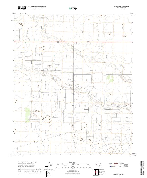
2022 Map of Paynes Corner
USGS Topo · Published 2022About this map
Seminole Draw carves a subtle path through the High Plains of Gaines County, defining the drainage patterns in this corner of West Texas. This modern survey illustrates a landscape primarily organized by a rigid grid of county roads, such as Co Rd 323 and Co Rd 315, which serve the expansive agricultural and ranching operations of the region. The map captures the infrastructure of the Permian Basin's surface, where local thoroughfares like Nadine Rd and Ranch Rd 181 provide the vital links between remote homesteads and larger regional hubs. This network of dirt and paved roads, including FM 1757, reflects the systematic land use that has characterized the Llano Estacado since the mid-20th century.
Find a feature on this map
19 named features on this map. Tap any name to fly to it.
Don’t see what you’re looking for? This feature index may not catch every label — zoom into the map to look around manually.
Map Details
Editions of this 2022 Paynes Corner Map
This is the sole edition of this map. No revisions or reprints were ever made.
Other maps of this area

1954 · Hobbs
USGS Topo · 1:250,000

1958 · Hobbs
USGS Topo · 1:250,000

1969 · Seminole SW
USGS Topo · 1:24,000

1970 · Seagraves SW
USGS Topo · 1:24,000

1970 · Seminole
USGS Topo · 1:24,000

1971 · Paynes Corner
USGS Topo · 1:24,000

1971 · Brinson Ranch
USGS Topo · 1:24,000

1971 · Paynes Corner SE
USGS Topo · 1:24,000

1971 · Denver City SW
USGS Topo · 1:24,000
1971 · Paynes Corner NW
USGS Topo · 1:24,000