
1970 Map of Seminole
USGS Topo · Published 1974About this map
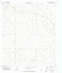
Seminole serves as the focal point of this West Texas survey, showing a concentrated urban grid defined by NW Ave, NE Ave, and other directional thoroughfares that center on the Courthouse. The landscape is dominated by the petroleum and ranching economy, with the expansive Doss-Robertson Field and numerous pipelines cutting across the terrain. Public life in the 1970s is evidenced by a cluster of educational facilities, including High Sch, Jr HS, and Young Sch, alongside local landmarks like the Drive-in Theater and Athletic Fields. The natural geography is marked by the winding paths of Seminole Draw and Wardswell Draw, which disrupt the otherwise orderly arrangement of gravel pits and sandpits. This documentation captures the community just as the Seminole Area Airport and regional radio infrastructure, such as Radio Tower (KIKZ), were supporting the town's role as a regional hub.
Find a feature on this map
25 named features on this map. Tap any name to fly to it.
Don’t see what you’re looking for? This feature index may not catch every label — zoom into the map to look around manually.
Map Details
Editions of this 1970 Seminole Map
This is the sole edition of this map. No revisions or reprints were ever made.
Other maps of this area

1954 · Hobbs
USGS Topo · 1:250,000

1958 · Hobbs
USGS Topo · 1:250,000

1969 · Seminole SW
USGS Topo · 1:24,000

1970 · Seagraves SW
USGS Topo · 1:24,000

1970 · Seminole NE
USGS Topo · 1:24,000

1970 · Seagraves SE
USGS Topo · 1:24,000

1970 · Seminole SE
USGS Topo · 1:24,000

1971 · Paynes Corner
USGS Topo · 1:24,000

1971 · Paynes Corner SE
USGS Topo · 1:24,000
1971 · Denver City SE
USGS Topo · 1:24,000