
1971 Map of Paynes Corner
USGS Topo · Published 1973About this map
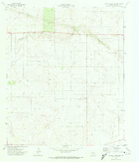
North Riley Oil Field and the Riley Oil Field dominate this West Texas landscape, illustrating the intensive petroleum development characteristic of Gaines County in the early 1970s. The terrain is marked by a dense network of unimproved roads and pipelines connecting numerous individual wells. Centered on the crossroads of Paynes Corner, the map reveals a technical landscape where industrial infrastructure like the Riley Gas Plant, a Radio Tower, and various Gravel Pits are the primary landmarks. Natural features are scarce, defined primarily by the winding path of Seminole Draw which cuts across the central portion of the quadrangle. This survey, based on 1970 aerial photography, provides a clear view of the Doss Robertson Oil Field and the supporting utility network of substations and storage bins that powered the regional energy economy.
Find a feature on this map
11 named features on this map. Tap any name to fly to it.
Don’t see what you’re looking for? This feature index may not catch every label — zoom into the map to look around manually.
Map Details
Editions of this 1971 Paynes Corner Map
This is the sole edition of this map. No revisions or reprints were ever made.
Other maps of this area

1954 · Hobbs
USGS Topo · 1:250,000

1958 · Hobbs
USGS Topo · 1:250,000

1969 · Seminole SW
USGS Topo · 1:24,000

1970 · Seagraves SW
USGS Topo · 1:24,000

1970 · Seminole
USGS Topo · 1:24,000

1971 · Brinson Ranch
USGS Topo · 1:24,000

1971 · Paynes Corner SE
USGS Topo · 1:24,000

1971 · Denver City SW
USGS Topo · 1:24,000
1971 · Paynes Corner NW
USGS Topo · 1:24,000
1971 · Denver City SE
USGS Topo · 1:24,000