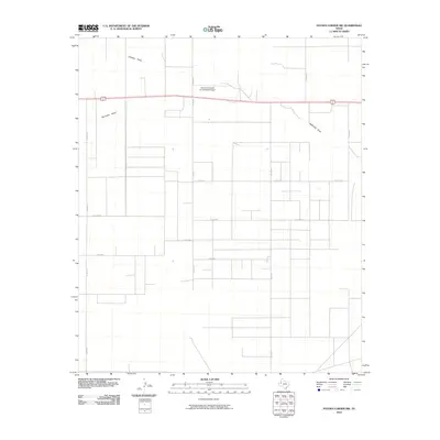
2010 Map of Paynes Corner NW
USGS Topo · Published 2010About this map
Hamilton Aircraft Incorporated Airport anchors the northern landscape of this Gaines County quadrangle, situated just north of the major east-west corridor of U.S. Route 180 and 62. The terrain is defined by the intermittent drainage patterns of Johnson Draw and Seminole Draw, which cross the high plains in an area dominated by a rigid grid of rural county roads. This network, including routes like Co Rd 304 and Co Rd 306, reflects the systematic land partitioning typical of the Texas Panhandle. The map illustrates a primarily agricultural or open-range environment where transportation is dictated by long, straight sections of pavement and dirt, essential for connecting remote ranching operations to the larger regional hubs.
Find a feature on this map
15 named features on this map. Tap any name to fly to it.
Don’t see what you’re looking for? This feature index may not catch every label — zoom into the map to look around manually.
Map Details
Editions of this 2010 Paynes Corner NW Map
This is the sole edition of this map. No revisions or reprints were ever made.
Other maps of this area

1954 · Hobbs
USGS Topo · 1:250,000

1958 · Hobbs
USGS Topo · 1:250,000

1969 · Hobbs East
USGS Topo · 1:24,000

1969 · Hobbs SE
USGS Topo · 1:24,000

1969 · Humble City SE
USGS Topo · 1:24,000

1970 · Humble City SE
USGS Topo · 1:24,000

1971 · Paynes Corner
USGS Topo · 1:24,000

1971 · Brinson Ranch
USGS Topo · 1:24,000

1971 · Paynes Corner SE
USGS Topo · 1:24,000

1971 · Denver City SW
USGS Topo · 1:24,000