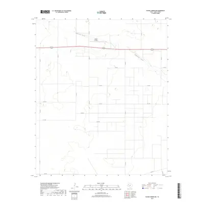
2019 Map of Paynes Corner NW
USGS Topo · Published 2019About this map
Hamilton Aircraft, Inc Airport sits prominently in the northern section of this Gaines County landscape, serving as a distinct aeronautical landmark in an area otherwise characterized by vast agricultural and ranching plots. The terrain is defined by two major natural drainage systems: Johnson Draw in the northwest and Seminole Draw to the east. These ephemeral waterways cut through the High Plains, providing the only significant relief in the otherwise uniform topography. A systematic grid of section roads, such as Co Rd 237 and Co Rd 335, underscores the organized land division typical of West Texas. Modern transportation is anchored by the shared corridor of US Highway 62/180, which traverses the map horizontally, connecting the sparse local infrastructure to the broader regional network. The southern edge is marked by the presence of Nadine Rd, framing the lower bounds of this rural survey.
Find a feature on this map
18 named features on this map. Tap any name to fly to it.
Don’t see what you’re looking for? This feature index may not catch every label — zoom into the map to look around manually.
Map Details
Editions of this 2019 Paynes Corner NW Map
This is the sole edition of this map. No revisions or reprints were ever made.
Other maps of this area

1954 · Hobbs
USGS Topo · 1:250,000

1958 · Hobbs
USGS Topo · 1:250,000

1969 · Hobbs East
USGS Topo · 1:24,000

1969 · Hobbs SE
USGS Topo · 1:24,000

1969 · Humble City SE
USGS Topo · 1:24,000

1970 · Humble City SE
USGS Topo · 1:24,000

1971 · Paynes Corner
USGS Topo · 1:24,000

1971 · Brinson Ranch
USGS Topo · 1:24,000

1971 · Paynes Corner SE
USGS Topo · 1:24,000

1971 · Denver City SW
USGS Topo · 1:24,000