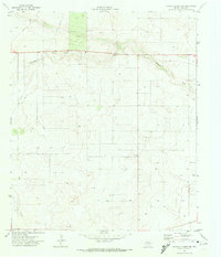
1971 Map of Paynes Corner NW
USGS Topo · Published 1974About this map
Seminole Draw carves a path through the Llano Estacado landscape of Gaines County in this early 1970s survey. The terrain is defined by a dense network of extraction and transit, evidenced by several Gravel Pits and an extensive Pipeline corridor crossing the plains. Local infrastructure is minimal but specific, featuring a small Cem and a Roadside Park located near the draw's edge. Scattered water sources, including a Water Tank and numerous wells, speak to the vital importance of irrigation and water management in this semi-arid region of West Texas during a period of steady petroleum and agricultural development.
Find a feature on this map
7 named features on this map. Tap any name to fly to it.
Don’t see what you’re looking for? This feature index may not catch every label — zoom into the map to look around manually.
Map Details
Editions of this 1971 Paynes Corner NW Map
This is the sole edition of this map. No revisions or reprints were ever made.
Other maps of this area

1954 · Hobbs
USGS Topo · 1:250,000

1958 · Hobbs
USGS Topo · 1:250,000

1969 · Hobbs East
USGS Topo · 1:24,000

1969 · Hobbs SE
USGS Topo · 1:24,000

1969 · Humble City SE
USGS Topo · 1:24,000

1970 · Humble City SE
USGS Topo · 1:24,000

1971 · Paynes Corner
USGS Topo · 1:24,000

1971 · Brinson Ranch
USGS Topo · 1:24,000

1971 · Paynes Corner SE
USGS Topo · 1:24,000

1971 · Denver City SW
USGS Topo · 1:24,000