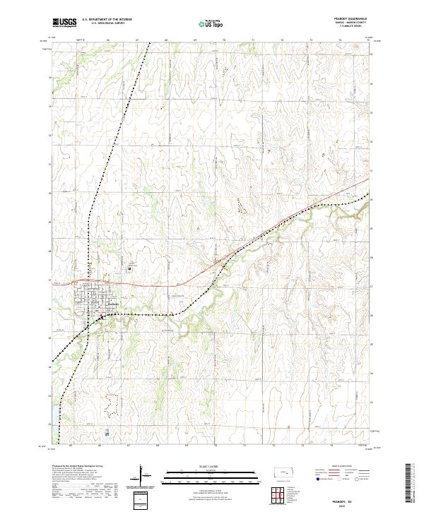
2022 Map of Peabody
USGS Topo · Published 2022About this map
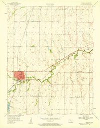
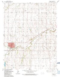
The town of Peabody serves as the central hub of this Kansas landscape, where a grid of residential streets like N Sycamore St and N Locust St meets the open agricultural plains. Situated along the banks of Doyle Cr, the settlement is characterized by its organized urban plan, which includes the Prairie Lawn Cem situated just to the northeast. The surrounding terrain is defined by the gentle drainage of Spring Cr and a dense network of sectional roads, many of which carry family or regional names such as Old Mill Rd and Nighthawk Rd. This layout reflects the long-standing land survey system of the American Midwest, where the township and range lines of t21s r3e and t21s r4e dictate the movement of both people and water across the Marion County prairie.
Find a feature on this map
55 named features on this map. Tap any name to fly to it.
Don’t see what you’re looking for? This feature index may not catch every label — zoom into the map to look around manually.
Map Details
Editions of this 2022 Peabody Map
This is the sole edition of this map. No revisions or reprints were ever made.