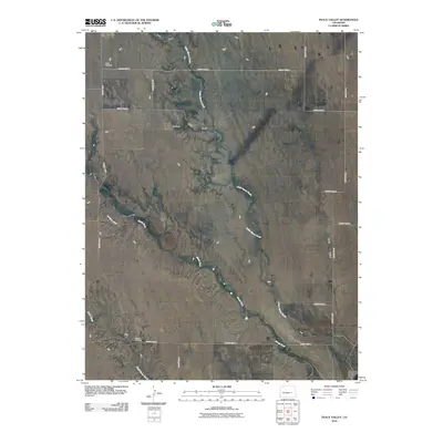
2010 Map of Peace Valley
USGS Topo · Published 2010About this map
Kirkland Cemetery and the namesake Peace Valley terrain define this pocket of the eastern Colorado plains. The landscape is characterized by a sparse network of ephemeral drainages such as Little Horse Creek, Steels Fork, and Pats Draw, which shape the gentle topography of the high prairie. Human presence is marked by a rigid grid of rural roads and isolated landmarks such as the Andy Windmill and a site labeled Seldom.
Find a feature on this map
22 named features on this map. Tap any name to fly to it.
Don’t see what you’re looking for? This feature index may not catch every label — zoom into the map to look around manually.
Map Details
Editions of this 2010 Peace Valley Map
This is the sole edition of this map. No revisions or reprints were ever made.
Other maps of this area

1889 · Sanborn
USGS Topo · 1:125,000

1891 · Sanborn
USGS Topo · 1:125,000

1893 · Sanborn
USGS Topo · 1:125,000

1954 · Lamar
USGS Topo · 1:250,000

1958 · Lamar
USGS Topo · 1:250,000

1977 · Walker Point
USGS Topo · 1:24,000

1977 · Punkin Center
USGS Topo · 1:24,000
1978 · Cockleburr Springs
USGS Topo · 1:24,000
1978 · Peace Valley
USGS Topo · 1:24,000
1978 · Sanborn Reservoir
USGS Topo · 1:24,000