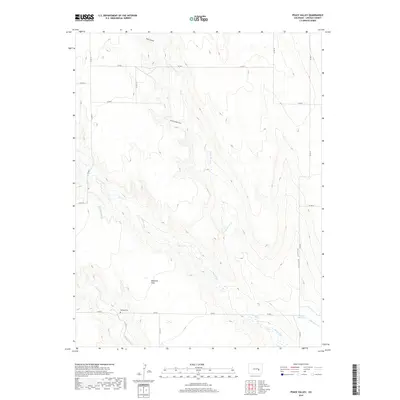
2019 Map of Peace Valley
USGS Topo · Published 2019About this map
Kirkland Cem serves as a small but significant local history landmark within this rural Lincoln County landscape, situated near the intersection of Co RD J and Co RD 11. This area of eastern Colorado is defined by its drainage systems and subtle topography, where Little Horse Cr and Steels Fork wind across the terrain toward the south. The map illustrates a developed network of county roads, such as Co RD S and Co RD R, which segment the plains into a regular grid, supporting the remote ranching and agricultural operations of the region.
Find a feature on this map
25 named features on this map. Tap any name to fly to it.
Don’t see what you’re looking for? This feature index may not catch every label — zoom into the map to look around manually.
Map Details
Editions of this 2019 Peace Valley Map
This is the sole edition of this map. No revisions or reprints were ever made.
Other maps of this area

1889 · Sanborn
USGS Topo · 1:125,000

1891 · Sanborn
USGS Topo · 1:125,000

1893 · Sanborn
USGS Topo · 1:125,000

1954 · Lamar
USGS Topo · 1:250,000

1958 · Lamar
USGS Topo · 1:250,000

1977 · Walker Point
USGS Topo · 1:24,000

1977 · Punkin Center
USGS Topo · 1:24,000
1978 · Cockleburr Springs
USGS Topo · 1:24,000
1978 · Peace Valley
USGS Topo · 1:24,000
1978 · Sanborn Reservoir
USGS Topo · 1:24,000