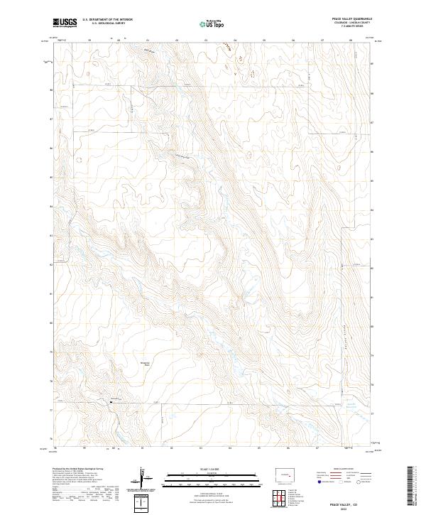
2022 Map of Peace Valley
USGS Topo · Published 2022About this map
Kirkland Cem sits at the intersection of early road networks and prairie drainages, marking a focal point for genealogy in this corner of Lincoln County. The landscape is defined by the subtle topography of the Great Plains, where seasonal waterways like Steels Fork and Little Horse Cr converge near the broad expanse of Ninemile Flats. The reliance on water management in this arid environment is evident through features such as Douglas Ditch and the Kuester Reservoir, which are critical components of the local ranching infrastructure.
Find a feature on this map
25 named features on this map. Tap any name to fly to it.
Don’t see what you’re looking for? This feature index may not catch every label — zoom into the map to look around manually.
Map Details
Editions of this 2022 Peace Valley Map
This is the sole edition of this map. No revisions or reprints were ever made.
Other maps of this area

1889 · Sanborn
USGS Topo · 1:125,000

1891 · Sanborn
USGS Topo · 1:125,000

1893 · Sanborn
USGS Topo · 1:125,000

1954 · Lamar
USGS Topo · 1:250,000

1958 · Lamar
USGS Topo · 1:250,000

1977 · Walker Point
USGS Topo · 1:24,000

1977 · Punkin Center
USGS Topo · 1:24,000
1978 · Cockleburr Springs
USGS Topo · 1:24,000
1978 · Peace Valley
USGS Topo · 1:24,000
1978 · Sanborn Reservoir
USGS Topo · 1:24,000