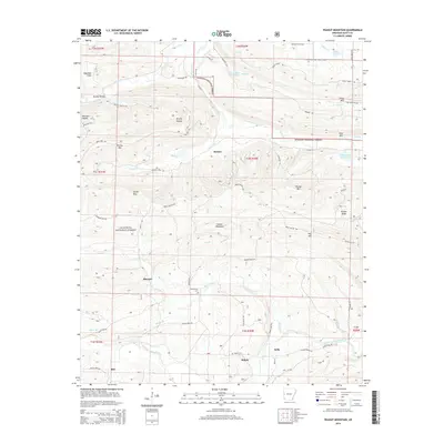
2014 Map of Peanut Mountain
USGS Topo · Published 2014About this map
Peanut Mountain rises as a central landmark within this portion of the Ouachita National Forest, where the complex drainage systems of the Poteau River and the Fourche LaFave River meet. The landscape is defined by its numerous named hollows and ridges, such as Brushy Hollow and Bruton Ridge, which dictated the early settlement patterns and road networks of Scott County. Small communities like Blansett, Denton, and Shiloh are connected by a web of local routes including the Boles Motor Way. Local history is preserved at sites like Shiloh Cem and Whisenhunt Cem, which sit alongside the narrow valleys of Henry Br and Black Fork. The map shows a transition from the higher elevations of Henry Mtn and Rowdy Mtn toward the more accessible terrain of Dogwood Flats, illustrating how the geography influenced both timber management and rural habitation.
Find a feature on this map
75 named features on this map. Tap any name to fly to it.
Don’t see what you’re looking for? This feature index may not catch every label — zoom into the map to look around manually.
Map Details
Editions of this 2014 Peanut Mountain Map
This is the sole edition of this map. No revisions or reprints were ever made.
Other maps of this area

1879 · Poteau Mountain
USGS Topo · 1:62,500

1887 · Poteau Mountain #1
USGS Topo · 1:62,500

1887 · Poteau Mountain #2
USGS Topo · 1:62,500

1890 · Poteau Mountain
USGS Topo · 1:125,000

1899 · Poteau Mountain
USGS Topo · 1:125,000

1939 · Waldron
USGS Topo · 1:62,500

1940 · Waldron
USGS Topo · 1:62,500

1941 · Waldron
USGS Topo · 1:62,500

1949 · Waldron
USGS Topo · 1:62,500

1950 · Mcalester
USGS Topo · 1:250,000