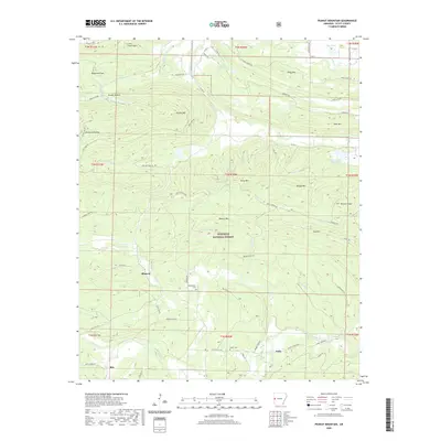
2020 Map of Peanut Mountain
USGS Topo · Published 2020About this map
Peanut Mtn rises at the center of this landscape within the Ouachita National Forest, surrounded by a network of peaks including Ross Mtn, Rowdy Mtn, and Key Mtn. Small rural communities and topographic landmarks define the region, with Blansett situated near the junction of Black Fork and several forest roads. To the south, the settlement of Ritz sits near the Clear Fork, while the area around Nella is marked by the Shiloh Cem and the Fouche La Fave River. The terrain is deeply carved by drainage systems like Denton Cr and Henry Br, which flow through hollows such as Brushy Hollow and Whitlock Hollow. Local history is anchored by sites like Whisenhunt Cem and the water management features of the Poteau River Site 17 Lake and Poteau River Site 18 Lake, reflecting the intersection of natural topography and federal land management in Scott County.
Find a feature on this map
76 named features on this map. Tap any name to fly to it.
Don’t see what you’re looking for? This feature index may not catch every label — zoom into the map to look around manually.
Map Details
Editions of this 2020 Peanut Mountain Map
This is the sole edition of this map. No revisions or reprints were ever made.
Other maps of this area

1879 · Poteau Mountain
USGS Topo · 1:62,500

1887 · Poteau Mountain #1
USGS Topo · 1:62,500

1887 · Poteau Mountain #2
USGS Topo · 1:62,500

1890 · Poteau Mountain
USGS Topo · 1:125,000

1899 · Poteau Mountain
USGS Topo · 1:125,000

1939 · Waldron
USGS Topo · 1:62,500

1940 · Waldron
USGS Topo · 1:62,500

1941 · Waldron
USGS Topo · 1:62,500

1949 · Waldron
USGS Topo · 1:62,500

1950 · Mcalester
USGS Topo · 1:250,000