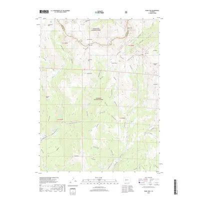
2019 Map of Pearl Pass
USGS Topo · Published 2019About this map
The high alpine boundary between Pitkin Co and Gunnison Co defines this 2019 survey, centered on the historic Pearl Pass. This rugged high-altitude landscape is dominated by the Elk Mountains, where prominent summits like Pearl Mtn, Star Peak, and Taylor Peak reach deep into the White River National Forest and Gunnison National Forest. The map documents a complex network of seasonal routes and trails, including the Brush Creek Ski (Snow) path and the Block and Tackle trail, which reflect the modern recreational use of these traditional mountain corridors.
Find a feature on this map
50 named features on this map. Tap any name to fly to it.
Don’t see what you’re looking for? This feature index may not catch every label — zoom into the map to look around manually.
Map Details
Editions of this 2019 Pearl Pass Map
This is the sole edition of this map. No revisions or reprints were ever made.
Other maps of this area

1888 · Crested Butte
USGS Topo · 1:62,500

1889 · Crested Butte
USGS Topo · 1:62,500

1893 · Crested Butte
USGS Topo · 1:62,500

1893 · Aspen
USGS Topo · 1:62,500

1895 · Aspen
USGS Topo · 1:62,500

1909 · Mount Jackson
USGS Topo · 1:125,000

1911 · Mount Jackson
USGS Topo · 1:125,000

1934 · Taylor Park
USGS Topo · 1:62,500

1937 · Taylor Park
USGS Topo · 1:62,500

1956 · Montrose
USGS Topo · 1:250,000