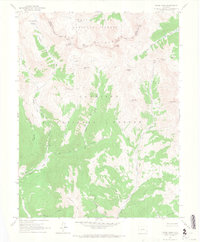
1961 Map of Pearl Pass
USGS Topo · Published 1968About this map
The Elk Mountains form a high-altitude divide in the early 1960s, marking the boundary between the White River National Forest and Gunnison National Forest. This high-country survey captures the primitive transportation network of the era, defined by a sparse system of Jeep Trails and Pack Trails that provided the only access to remote alpine basins. High peaks like Pearl Mountain, Star Peak, and Taylor Peak tower over the landscape, while the presence of mines and prospects near Carbonate Hill and Eyre Basin indicates a legacy of mineral exploration above the timberline.
Find a feature on this map
30 named features on this map. Tap any name to fly to it.
Don’t see what you’re looking for? This feature index may not catch every label — zoom into the map to look around manually.
Map Details
Editions of this 1961 Pearl Pass Map
3 editions found
Other maps of this area

1888 · Crested Butte
USGS Topo · 1:62,500

1889 · Crested Butte
USGS Topo · 1:62,500

1893 · Crested Butte
USGS Topo · 1:62,500

1893 · Aspen
USGS Topo · 1:62,500

1895 · Aspen
USGS Topo · 1:62,500

1909 · Mount Jackson
USGS Topo · 1:125,000

1911 · Mount Jackson
USGS Topo · 1:125,000

1934 · Taylor Park
USGS Topo · 1:62,500

1937 · Taylor Park
USGS Topo · 1:62,500

1956 · Montrose
USGS Topo · 1:250,000