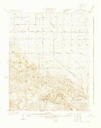
1930 Map of Pearland
USGS Topo · Published 1930About this map
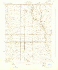
Pearland emerges as a focal point of early twentieth-century desert development within the high Antelope Valley. This 1930 survey, directed by County Surveyor J. E. Rockhold, illustrates a landscape defined by an ambitious grid of orchard-era streets such as Pear Blossom Highway and Mariposa Street. The mapping reveals the essential water infrastructure required for high-desert agriculture, documenting numerous wells and the Little Rock Ditch that sustained local growers. Historical transportation routes are a primary feature, including the Southern Pacific railroad line and the historic Old Fort Tejon Road, which cuts diagonally across the undulating terrain. To the west, the Palmdale Cemetery stands as a permanent record of early local families. The detail provided for the First Standard Parallel North and the intricate drainage of Rock Wash provides a clear view of the area's physical and surveyed geography before modern expansion.
Find a feature on this map
18 named features on this map. Tap any name to fly to it.
Don’t see what you’re looking for? This feature index may not catch every label — zoom into the map to look around manually.
Map Details
Editions of this 1930 Pearland Map
This is the sole edition of this map. No revisions or reprints were ever made.
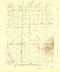
Other maps of this area

1900 · Tujunga
USGS Topo · 1:62,500

1901 · Southern California Sheet No. 1
USGS Topo · 1:250,000

1903 · Rock Creek
USGS Topo · 1:62,500

1904 · Southern California Sheet No. 1
USGS Topo · 1:250,000

1915 · Elizabeth Lake
USGS Topo · 1:125,000

1917 · Elizabeth Lake
USGS Topo · 1:125,000
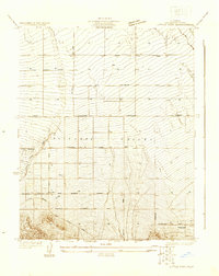
1930 · Little Rock
USGS Topo · 1:24,000
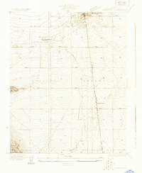
1930 · Lancaster
USGS Topo · 1:24,000
1930 · West Alpine Butte
USGS Topo · 1:24,000
1930 · Tierra Bonita
USGS Topo · 1:24,000