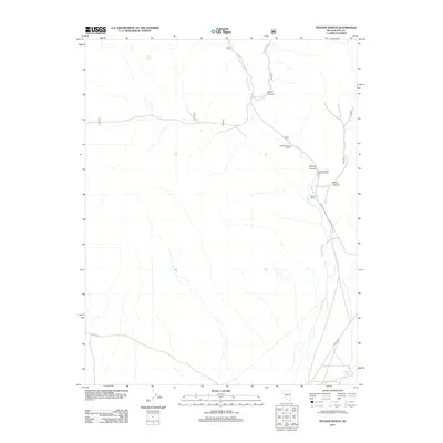
2011 Map of Peavine Ranch
USGS Topo · Published 2011About this map
Peavine Ranch and Upper Peavine Ranch are central landmarks in this high-desert landscape of Nye County. The area is defined by the drainage systems of Peavine Creek and Horse Creek, which carve significant paths through Peavine Canyon and Horse Canyon. These water sources, supplemented by Seyler Spring and Mustang Spring, dictate the placement of ranching outposts and federal infrastructure like the Peavine Forest Service Facility. Modern access follows the Fremont Rte and various forest roads, reflecting a landscape used for both public land management and private ranching. The topographical layout shows how the canyon floors and springs provide the necessary geography for habitation and resource management in an otherwise arid environment.
Find a feature on this map
13 named features on this map. Tap any name to fly to it.
Don’t see what you’re looking for? This feature index may not catch every label — zoom into the map to look around manually.
Map Details
Editions of this 2011 Peavine Ranch Map
This is the sole edition of this map. No revisions or reprints were ever made.
Other maps of this area

1907 · Tonopah
USGS Topo · 1:250,000

1908 · Tonopah
USGS Topo · 1:250,000

1956 · Tonopah
USGS Topo · 1:250,000

1959 · Tonopah
USGS Topo · 1:250,000

1962 · Tonopah
USGS Topo · 1:250,000

1963 · Baxter Spring
USGS Topo · 1:62,500

1964 · San Antonio Ranch
USGS Topo · 1:62,500

1971 · Seyler Peak
USGS Topo · 1:24,000

1971 · Pablo Canyon Ranch
USGS Topo · 1:24,000

1980 · Secret Basin
USGS Topo · 1:24,000