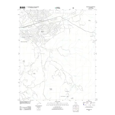
2012 Map of Pechanga
USGS Topo · Published 2012About this map
Temecula Ranchos and the surrounding residential developments of Colina Vista and Rainbow Canyon Village dominate the northern portion of this Riverside County landscape. The area is defined by its valleys, specifically Pauba Valley and Wolf Valley, where modern street grids and suburban expansions follow the natural contours of the land. Further south, the terrain shifts into a complex network of peaks and ridges, including the prominent Tourmaline Queen Mountain, Chief Mountain, and Mount Olympus. This transition from the built environment of northern settlements to the high country illustrates the region's topographical diversity. Local water sources like Pechanga Cr and Pala Cr cut through these uplands, while the presence of the Rainbow Conservation Camp and Pechanga Hot Springs reflects specialized land use in the more secluded southern reaches of the quadrangle.
Find a feature on this map
77 named features on this map. Tap any name to fly to it.
Don’t see what you’re looking for? This feature index may not catch every label — zoom into the map to look around manually.
Map Details
Editions of this 2012 Pechanga Map
This is the sole edition of this map. No revisions or reprints were ever made.
Other maps of this area

1901 · Southern California Sheet No. 1
USGS Topo · 1:250,000

1901 · San Jacinto
USGS Topo · 1:125,000

1901 · Elsinore
USGS Topo · 1:125,000

1901 · San Luis Rey
USGS Topo · 1:125,000

1903 · Ramona
USGS Topo · 1:125,000

1904 · Southern California Sheet No. 2
USGS Topo · 1:250,000

1904 · Southern California Sheet No. 1
USGS Topo · 1:250,000

1939 · Palomar Mountain
USGS Topo · 1:62,500

1942 · Temecula
USGS Topo · 1:62,500

1942 · Hemet
USGS Topo · 1:62,500