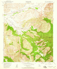
1949 Map of Pechanga
USGS Topo · Published 1959About this map
Pechanga Indian Reservation and the surrounding borderlands of Riverside and San Diego counties reveal a mid-century landscape of remote ranching and active mineral extraction. The rugged terrain, dominated by Temecula Creek and Agua Tibia Mountain, is marked by the presence of numerous gem and tourmaline mines including the Tourmaline King Mine and Stewart Mine in the Pala Indian Reservation area. Local history is anchored at sites like San Gabriel Church and an Indian Burial Ground, alongside established agricultural holdings like Pauba Ranch and Yampa Ranch. The infrastructure of the era is evidenced by the prominent path of the San Diego Aqueduct cutting across the northwestern quadrant, while fire lookouts and remote routes like the Palomar Divide Truck Trail navigate the dense growth of the Cleveland National Forest.
Find a feature on this map
41 named features on this map. Tap any name to fly to it.
Don’t see what you’re looking for? This feature index may not catch every label — zoom into the map to look around manually.
Map Details
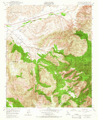
Editions of this 1949 Pechanga Map
2 editions found
Other maps of this area

1901 · Southern California Sheet No. 1
USGS Topo · 1:250,000

1901 · San Jacinto
USGS Topo · 1:125,000

1901 · Elsinore
USGS Topo · 1:125,000

1901 · San Luis Rey
USGS Topo · 1:125,000

1903 · Ramona
USGS Topo · 1:125,000

1904 · Southern California Sheet No. 2
USGS Topo · 1:250,000

1904 · Southern California Sheet No. 1
USGS Topo · 1:250,000

1939 · Palomar Mountain
USGS Topo · 1:62,500

1942 · Temecula
USGS Topo · 1:62,500

1942 · Hemet
USGS Topo · 1:62,500