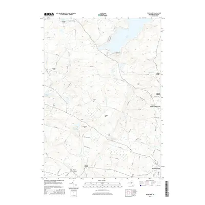
2016 Map of Peck Lake
USGS Topo · Published 2016About this map
Peck Lake and the surrounding Adirondack foothills define this region of Fulton County, where water resources were heavily managed for local industry and municipal use. The landscape is dotted with small reservoirs and ponds, including the Canajoharie Reservoir, Cold Brook Reservoir, and Cork Center Reservoir, which reflect the historic water needs of nearby urban centers. Small settlements like Cork, North Bush, and West Bush are connected by a network of secondary roads and county highways, such as Co Hwy 137 and Co Rd 116, revealing a pattern of rural development that spans from the northern lakefronts down toward the fringes of larger hubs. Numerous family-named landmarks, including Erkenbrack Hill, Clapper Hill, and Peck Hill, emphasize the local lineage of the land. For genealogists, the map identifies several burial grounds like Rhodes Cem, McBeth Cem, and Keeks Center Cem, providing key points of reference for tracing early resident families.
Find a feature on this map
86 named features on this map. Tap any name to fly to it.
Don’t see what you’re looking for? This feature index may not catch every label — zoom into the map to look around manually.
Map Details
Editions of this 2016 Peck Lake Map
This is the sole edition of this map. No revisions or reprints were ever made.
Other maps of this area

1896 · Fonda
USGS Topo · 1:62,500

1898 · Fonda
USGS Topo · 1:62,500

1898 · Canajoharie
USGS Topo · 1:62,500

1900 · Canajoharie
USGS Topo · 1:62,500

1901 · Lassellsville
USGS Topo · 1:62,500

1902 · Canajoharie
USGS Topo · 1:62,500

1902 · Fonda
USGS Topo · 1:62,500

1903 · Gloversville
USGS Topo · 1:62,500

1903 · Lassellsville
USGS Topo · 1:62,500

1943 · Gloversville
USGS Topo · 1:62,500