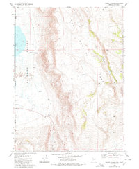
1980 Map of Pegleg Canyon
USGS Topo · Published 1980About this map
Surprise Valley serves as the central focal point of this high-desert landscape along the California and Nevada border. The area is defined by its critical water sources in an otherwise arid environment, ranging from the Lower Lake at the valley floor to specific landmarks like Murphy Spring and a notable Spring (Hot). Settlement is sparse, represented by the Murphy Ranch, while the surrounding terrain is dominated by the steep rises of Hays Canyon and the Copper Smith Hills.
Find a feature on this map
23 named features on this map. Tap any name to fly to it.
Don’t see what you’re looking for? This feature index may not catch every label — zoom into the map to look around manually.
Map Details
Editions of this 1980 Pegleg Canyon Map
This is the sole edition of this map. No revisions or reprints were ever made.
Other maps of this area

1886 · Alturas
USGS Topo · 1:250,000

1889 · Long Valley
USGS Topo · 1:250,000

1892 · Alturas
USGS Topo · 1:250,000

1954 · Vya
USGS Topo · 1:250,000

1954 · Alturas
USGS Topo · 1:250,000

1958 · Alturas
USGS Topo · 1:250,000

1958 · Vya
USGS Topo · 1:250,000

1962 · Alturas
USGS Topo · 1:250,000

1962 · Vya
USGS Topo · 1:250,000

1962 · Snake Lake
USGS Topo · 1:24,000