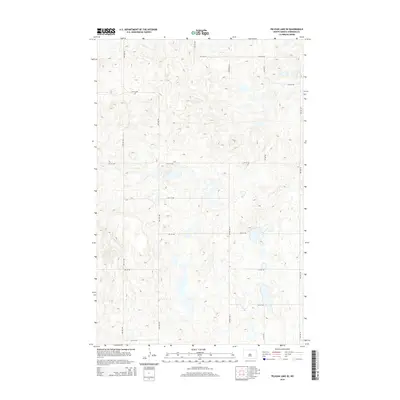
2014 Map of Pelican Lake SE
USGS Topo · Published 2014About this map
Sheridan County's prairie landscape is defined here by a precise section-line grid of rural roads and numerous small glacial wetlands. The geography is dominated by a recurring pattern of water and transit, with north-south arteries like Center Ave N, 1st Ave NW, and 2nd Ave NE providing the primary framework for local travel. These routes bisect a terrain dotted with countless unnamed potholes and seasonal basins characteristic of the North Dakota pothole region. Small east-west local roads such as 14th Sq NW, 11th ST NW, and 7th St NE connect the scattered homesteads and agricultural plots that comprise this quiet corner of the state. This 2014 survey documents the enduring structure of the Great Plains' rural infrastructure, where the survey grid remains the most prominent human mark on the land.
Find a feature on this map
19 named features on this map. Tap any name to fly to it.
Don’t see what you’re looking for? This feature index may not catch every label — zoom into the map to look around manually.
Map Details
Editions of this 2014 Pelican Lake SE Map
This is the sole edition of this map. No revisions or reprints were ever made.
Other maps of this area

1945 · Pelican Lake
USGS Topo · 1:62,500

1947 · Pelican Lake
USGS Topo · 1:62,500

1947 · Lincoln Valley
USGS Topo · 1:62,500

1954 · McClusky
USGS Topo · 1:250,000

1958 · McClusky
USGS Topo · 1:250,000

1959 · Pickardville
USGS Topo · 1:24,000

1959 · Mercer
USGS Topo · 1:24,000

1959 · McClusky
USGS Topo · 1:24,000
1960 · Lincoln Valley SW
USGS Topo · 1:24,000
1960 · Lincoln Valley NW
USGS Topo · 1:24,000