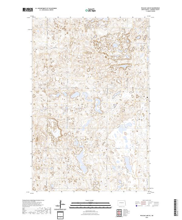
2024 Map of Pelican Lake SE
USGS Topo · Published 2024About this map
Sheridan County's glacial prairie landscape is defined by a dense network of sectional roads and unnamed water bodies in this contemporary survey. The terrain is structured by a precise grid of rural routes, including major thoroughfares such as Center Ave N and 14th St NW. The map details the complex hydrography of the region, where numerous small wetlands and basins are scattered across the Public Land Survey System divisions of t147n r78w and t148n r77w. This layout reflects the enduring influence of the homesteading era, as modern roads like 3rd Ave NW and 6th St NW continue to follow the original boundary lines established over a century ago. The absence of concentrated settlements highlights the area's predominantly agricultural and natural character, typical of the North Dakota interior.
Find a feature on this map
24 named features on this map. Tap any name to fly to it.
Don’t see what you’re looking for? This feature index may not catch every label — zoom into the map to look around manually.
Map Details
Editions of this 2024 Pelican Lake SE Map
This is the sole edition of this map. No revisions or reprints were ever made.
Other maps of this area

1945 · Pelican Lake
USGS Topo · 1:62,500

1947 · Pelican Lake
USGS Topo · 1:62,500

1947 · Lincoln Valley
USGS Topo · 1:62,500

1954 · McClusky
USGS Topo · 1:250,000

1958 · McClusky
USGS Topo · 1:250,000

1959 · Pickardville
USGS Topo · 1:24,000

1959 · Mercer
USGS Topo · 1:24,000

1959 · McClusky
USGS Topo · 1:24,000
1960 · Lincoln Valley SW
USGS Topo · 1:24,000
1960 · Lincoln Valley NW
USGS Topo · 1:24,000