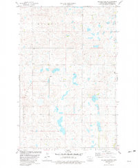
1981 Map of Pelican Lake SE
USGS Topo · Published 1982About this map
Prophets Mountains dominate the southwestern quadrant of this Sheridan County landscape, characterized by the irregular glacial topography of the Missouri Coteau. This 1981 survey reveals a territory defined by numerous small prairie potholes and wetlands scattered between rolling elevations, including the area of Holmes and the fringes of Pickard and Mcclusky. Human activity is marked by a section-line road grid and industrial features like a Gravel Pit in the central portion of the sheet. Evidence of early settlement persists in the form of a small rural Cem located near the eastern boundary, providing a point of interest for those researching local family history or the development of this prairie region before late-twentieth-century changes.
Find a feature on this map
6 named features on this map. Tap any name to fly to it.
Don’t see what you’re looking for? This feature index may not catch every label — zoom into the map to look around manually.
Map Details
Editions of this 1981 Pelican Lake SE Map
This is the sole edition of this map. No revisions or reprints were ever made.
Other maps of this area

1945 · Pelican Lake
USGS Topo · 1:62,500

1947 · Pelican Lake
USGS Topo · 1:62,500

1947 · Lincoln Valley
USGS Topo · 1:62,500

1954 · McClusky
USGS Topo · 1:250,000

1958 · McClusky
USGS Topo · 1:250,000

1959 · Pickardville
USGS Topo · 1:24,000

1959 · Mercer
USGS Topo · 1:24,000

1959 · McClusky
USGS Topo · 1:24,000
1960 · Lincoln Valley SW
USGS Topo · 1:24,000
1960 · Lincoln Valley NW
USGS Topo · 1:24,000