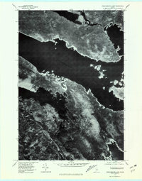
1978 Map of Pemadumcook Lake
USGS Topo · Published 1981About this map
Pemadumcook Lake dominates this late-1970s orthophotograph, serving as a massive hydraulic hub in the Maine wilderness. This imagery, captured by the Geological Survey, reveals the intricate shoreline of one of the state's largest water bodies before modern shoreline development changed the character of these remote reaches. To the northeast, the Penobscot River flows through the W Branch, connecting Ambajejus Lake into the broader river system. The map provides a stark visual record of the timber-rich landscape, showing the dense forest cover surrounding North Twin Lake and South Twin Lake. Topographical elevation is represented through the shadowed forms of Potaywadjo Ridge, while the drainage patterns of Cooper Brook feed into the Jo-Mary Lake and Middle Jo-Mary Lake chain, illustrating the primitive water-interconnectivity of the Piscataquis region.
Find a feature on this map
10 named features on this map. Tap any name to fly to it.
Don’t see what you’re looking for? This feature index may not catch every label — zoom into the map to look around manually.
Map Details
Editions of this 1978 Pemadumcook Lake Map
This is the sole edition of this map. No revisions or reprints were ever made.
Other maps of this area

1927 · Katahdin
USGS Topo · 1:48,000

1930 · Katahdin
USGS Topo · 1:62,500

1949 · Katahdin
USGS Topo · 1:62,500

1951 · Norcross
USGS Topo · 1:62,500

1952 · Jo-Mary Mountain
USGS Topo · 1:62,500

1954 · Harrington Lake
USGS Topo · 1:62,500

1954 · Millinocket
USGS Topo · 1:250,000

1958 · Millinocket
USGS Topo · 1:250,000

1960 · Millinocket
USGS Topo · 1:250,000
1978 · Trout Mountain
USGS Topo · 1:24,000