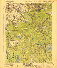
1942 Map of Pemberton
USGS Topo · Published 1942About this map
Pemberton serves as the hub of this 1940s landscape, where the agricultural and industrial traditions of the New Jersey Pine Barrens meet the expanding needs of the Fort Dix Military Reservation. The map details an intricate network of waterways and early industry, including sites like Hanover Furnace and the Mary Ann Furnace, reflecting the region’s history of iron production. Agricultural activity is evident at Whitesbog, while the natural terrain is preserved within the Lebanon State Forest.
Find a feature on this map
89 named features on this map. Tap any name to fly to it.
Don’t see what you’re looking for? This feature index may not catch every label — zoom into the map to look around manually.
Map Details
Editions of this 1942 Pemberton Map
This is the sole edition of this map. No revisions or reprints were ever made.
Other maps of this area

1884 · Whitings
USGS Topo · 1:62,500

1888 · Bordentown
USGS Topo · 1:62,500

1888 · Pemberton
USGS Topo · 1:62,500

1888 · Little Egg Harbor
USGS Topo · 1:62,500

1888 · Mount Holly
USGS Topo · 1:62,500

1888 · Cassville
USGS Topo · 1:62,500

1888 · Whitings
USGS Topo · 1:62,500

1890 · Hammonton
USGS Topo · 1:62,500

1890 · Burlington
USGS Topo · 1:62,500

1890 · Mullica
USGS Topo · 1:62,500
Featured Places
- Southampton Township, NJ
- Plumsted Township, NJ
- Tabernacle Township, NJ
- Eastampton Township, NJ
- Springfield Township, NJ