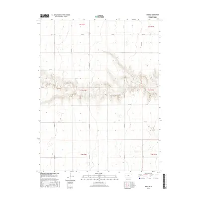
2015 Map of Pence SE
USGS Topo · Published 2015About this map
Deep ravines and dramatic bluffs cut through the High Plains landscape of Scott County in this 2015 survey. The terrain is defined by a significant east-west escarpment that creates a sharp contrast between the flat upland agricultural sections and the broken topography of the center. A rigid grid of section-line roads, including N Apache Rd and N Cherokee Rd, organizes the ranching and farming land, while newer paths like N Dakota Rd navigate the more complex elevation changes near the center of the quadrangle. The map captures the intersection of several townships, notably t17s r34w and t17s r33w, illustrating the geometric precision of the Public Land Survey System in western Kansas. This specific area highlights the natural drainage patterns where water has carved through the limestone and shale, creating a distinct break in the otherwise uniform prairie.
Find a feature on this map
22 named features on this map. Tap any name to fly to it.
Don’t see what you’re looking for? This feature index may not catch every label — zoom into the map to look around manually.
Map Details
Editions of this 2015 Pence SE Map
This is the sole edition of this map. No revisions or reprints were ever made.
Other maps of this area

1939 · Lake Mc Bride
USGS Topo · 1:24,000

1939 · Sandon
USGS Topo · 1:62,500

1939 · Pence
USGS Topo · 1:62,500

1940 · Scott City
USGS Topo · 1:62,500

1941 · Modoc
USGS Topo · 1:62,500

1941 · Pence
USGS Topo · 1:62,500

1942 · Sandon
USGS Topo · 1:62,500

1942 · Lake Mc Bride
USGS Topo · 1:31,680

1951 · Scott City
USGS Topo · 1:62,500

1951 · Modoc
USGS Topo · 1:62,500