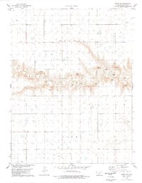
1978 Map of Pence SE
USGS Topo · Published 1978About this map
Ladder Creek carves a distinct path through the High Plains of western Kansas, cutting through the townships of Beaver and Isbel. The landscape is defined by the sharp contrast between the level upland flats and the complex drainage system of the creek, where numerous Gravel Pits and a solitary Gravel Pit indicate localized industrial activity. Agricultural operations are marked by several Feedlot locations and a network of water wells, reflecting the region's reliance on groundwater for livestock and farming. This 1970s survey, mapped from aerial photographs taken in 1974 and field-checked in 1976, captures the precise field boundaries and fence lines of the Scott County rural landscape during a period of established ranching and irrigation-based agriculture.
Find a feature on this map
7 named features on this map. Tap any name to fly to it.
Don’t see what you’re looking for? This feature index may not catch every label — zoom into the map to look around manually.
Map Details
Editions of this 1978 Pence SE Map
This is the sole edition of this map. No revisions or reprints were ever made.
Other maps of this area

1939 · Lake Mc Bride
USGS Topo · 1:24,000

1939 · Sandon
USGS Topo · 1:62,500

1939 · Pence
USGS Topo · 1:62,500

1940 · Scott City
USGS Topo · 1:62,500

1941 · Modoc
USGS Topo · 1:62,500

1941 · Pence
USGS Topo · 1:62,500

1942 · Sandon
USGS Topo · 1:62,500

1942 · Lake Mc Bride
USGS Topo · 1:31,680

1951 · Scott City
USGS Topo · 1:62,500

1951 · Modoc
USGS Topo · 1:62,500