Loading...
Loading map...2024 Map of Pendleton
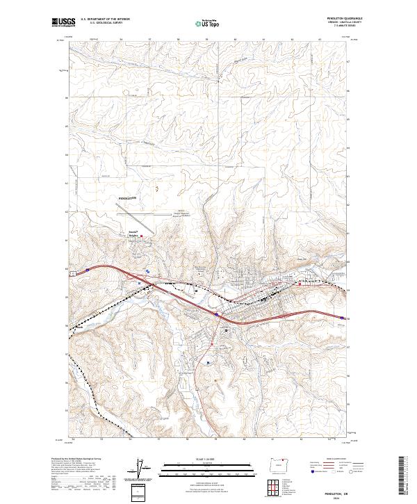
USGS Topo · Published 2024About this map
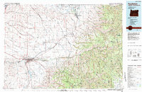
The Umatilla River cuts through the center of this modern landscape, where the city of Pendleton serves as a regional hub for government and education. Modern infrastructure is prominent, from the Umatilla County Courthouse and Blue Mountain Community College to the Eastern Oregon Regional Airport at Pendleton. The urban grid is bordered by residential areas like Pendair Heights and the industrial character of Rieth to the west.
Find a feature on this map
116 named features on this map. Tap any name to fly to it.
Don’t see what you’re looking for? This feature index may not catch every label — zoom into the map to look around manually.
Map Details
Date Portrayed2024
Date Published2024
PublisherU.S. Geological Survey
Map TypeTopographic
Scale1:24000
Physical Dimensions24 x 29 inches
Editions of this 2024 Pendleton Map
This is the sole edition of this map. No revisions or reprints were ever made.
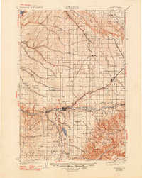
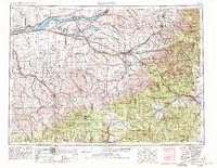
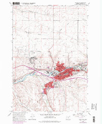
Historical Maps of Pendleton Through Time
6 maps found

Featured Locations
Source Details
SourceU.S. Geological Survey
CopyrightPublic Domain