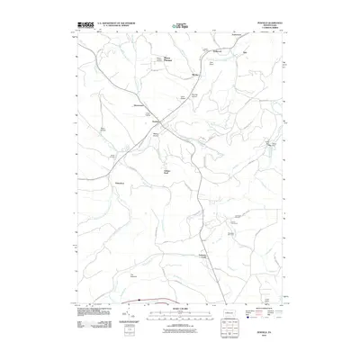
2010 Map of Penfield
USGS Topo · Published 2010About this map
Bennett Branch Sinnemahoning Creek flows through this corner of Clearfield County, anchoring a landscape defined by small settlements and numerous tributary runs. The community of Penfield sits at a central crossroads, surrounded by smaller locales like Winterburn, Tyler, and Hollywood. The mapping of several recreational and hunting camps, including Crystal Spring Camp and Woodward Dam Camp, highlights the area's deep-rooted outdoor culture. Genealogy and local history are preserved in the locations of Mount Pleasant Cemetery, Bundy Cemetery, and Kooker Cemetery. Significant landmarks such as Parker Dam and the prominent Gobbler Knob define the local topography. The extensive network of secondary roads, such as Bark Camp RD and Weiss Grade RD, traces the paths used for resource extraction and land management throughout the 20th century.
Find a feature on this map
74 named features on this map. Tap any name to fly to it.
Don’t see what you’re looking for? This feature index may not catch every label — zoom into the map to look around manually.
Map Details
Editions of this 2010 Penfield Map
This is the sole edition of this map. No revisions or reprints were ever made.
Other maps of this area

1929 · Clearfield
USGS Topo · 1:48,000

1929 · Penfield
USGS Topo · 1:62,500

1932 · Clearfield
USGS Topo · 1:62,500

1932 · Penfield
USGS Topo · 1:62,500

1941 · Benezette
USGS Topo · 1:62,500

1941 · Ridgway
USGS Topo · 1:62,500

1943 · Benezette
USGS Topo · 1:62,500

1944 · Ridgway
USGS Topo · 1:62,500

1957 · Warren
USGS Topo · 1:250,000

1958 · Warren
USGS Topo · 1:250,000
Featured Places
- Tyler, Huston Township
- Hoovertown, Huston Township
- Jay Township, PA
- Penfield, Huston Township
- Winterburn, Huston Township