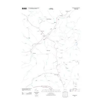
2013 Map of Penfield
USGS Topo · Published 2013About this map
Bennett Br Sinnemahoning Cr carves a central path through this section of the Pennsylvania wilds, anchoring a network of small settlements and camps. The village of Penfield serves as a primary hub, situated near the intersection of several local routes and the waters of Matley Run. To the northeast, the industrial and residential history of the region is evidenced by the proximity of Tyler, Hollywood, and Scattertown, while the high ground of Mount Pleasant overlooks the valley.
Find a feature on this map
113 named features on this map. Tap any name to fly to it.
Don’t see what you’re looking for? This feature index may not catch every label — zoom into the map to look around manually.
Map Details
Editions of this 2013 Penfield Map
This is the sole edition of this map. No revisions or reprints were ever made.
Other maps of this area

1929 · Clearfield
USGS Topo · 1:48,000

1929 · Penfield
USGS Topo · 1:62,500

1932 · Clearfield
USGS Topo · 1:62,500

1932 · Penfield
USGS Topo · 1:62,500

1941 · Benezette
USGS Topo · 1:62,500

1941 · Ridgway
USGS Topo · 1:62,500

1943 · Benezette
USGS Topo · 1:62,500

1944 · Ridgway
USGS Topo · 1:62,500

1957 · Warren
USGS Topo · 1:250,000

1958 · Warren
USGS Topo · 1:250,000
Featured Places
- Tyler, Huston Township
- Hoovertown, Huston Township
- Jay Township, PA
- Penfield, Huston Township
- Winterburn, Huston Township