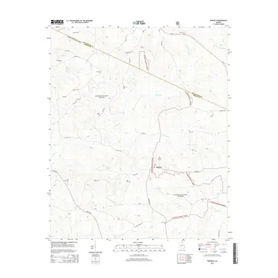
2014 Map of Penfield
USGS Topo · Published 2014About this map
The Penfield settlement serves as the focal point of this Greene County landscape, situated where the Oconee National Forest meets rolling agricultural lands. This territory is heavily defined by a high concentration of family and community burial grounds, including Macedonia Cem, Moore Cem, and Penfield Cem, suggesting a long-established rural population with deep genealogical roots. The boundary between Oglethorpe County and Greene County bisects the northern section, cutting across the watershed of Harris Cr and Fishing Cr.
Find a feature on this map
44 named features on this map. Tap any name to fly to it.
Don’t see what you’re looking for? This feature index may not catch every label — zoom into the map to look around manually.
Map Details
Editions of this 2014 Penfield Map
This is the sole edition of this map. No revisions or reprints were ever made.
Other maps of this area

1953 · Athens
USGS Topo · 1:250,000

1958 · Athens
USGS Topo · 1:250,000

1959 · Athens
USGS Topo · 1:250,000

1963 · Athens
USGS Topo · 1:250,000

1964 · Barnett Shoals
USGS Topo · 1:24,000

1965 · Woodville
USGS Topo · 1:24,000

1965 · Union Point
USGS Topo · 1:24,000

1971 · Maxeys
USGS Topo · 1:24,000
1971 · Lexington
USGS Topo · 1:24,000

1972 · Penfield
USGS Topo · 1:24,000