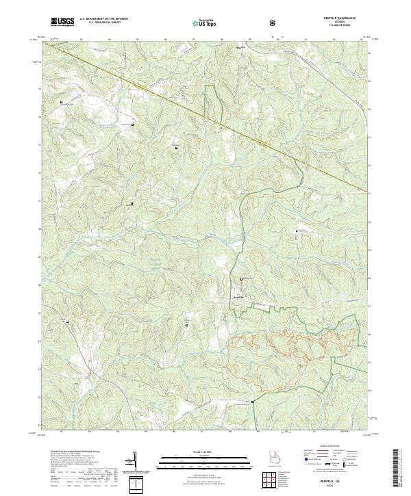
2024 Map of Penfield
USGS Topo · Published 2024About this map
The Oconee National Forest covers the central portion of this Greene County landscape, where the terrain is defined by the dendritic drainage of Town Creek and McWhorter Creek. The settlement of Penfield serves as a local focal point, surrounded by numerous family-named burial grounds that offer significant value for genealogical research, including the Penfield Cem, Janes Cem, and Moore Cem. To the north, the community of Maxeys sits near the border of Oglethorpe County, connected by a network of rural routes such as Union Point Rd and Penfield Rd. The presence of the Shiloh Baptist Church and its adjacent Shiloh Cem in the southern sector highlights the importance of rural congregations in shaping the social geography of the region. This topography reflects a classic Georgia Piedmont pattern of dispersed farmsteads and small crossroads communities separated by extensive timberland and creek bottoms.
Find a feature on this map
53 named features on this map. Tap any name to fly to it.
Don’t see what you’re looking for? This feature index may not catch every label — zoom into the map to look around manually.
Map Details
Editions of this 2024 Penfield Map
This is the sole edition of this map. No revisions or reprints were ever made.
Other maps of this area

1953 · Athens
USGS Topo · 1:250,000

1958 · Athens
USGS Topo · 1:250,000

1959 · Athens
USGS Topo · 1:250,000

1963 · Athens
USGS Topo · 1:250,000

1964 · Barnett Shoals
USGS Topo · 1:24,000

1965 · Woodville
USGS Topo · 1:24,000

1965 · Union Point
USGS Topo · 1:24,000

1971 · Maxeys
USGS Topo · 1:24,000
1971 · Lexington
USGS Topo · 1:24,000

1972 · Penfield
USGS Topo · 1:24,000