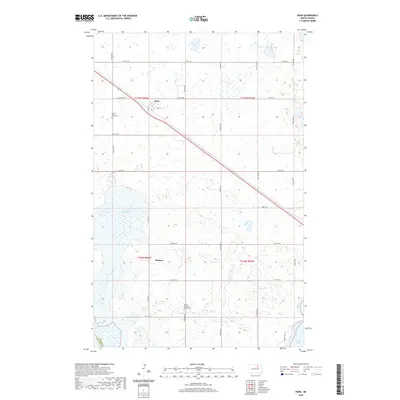
2020 Map of Penn
USGS Topo · Published 2020About this map
Penn sits at the heart of this North Dakota prairie landscape, where the intersection of Co Hwy 2 and 2nd St defines the small community's layout. The surrounding terrain in Ramsey is marked by the unique hydrology of the Devils Lake basin, including the edges of Pelican Lake, Oswalds Bay, and Sixmile Bay. These water bodies and their associated wetlands create a fragmented geography across the township grid. Local heritage is anchored by sites such as Saint Paul Cem to the west and Norway Lutheran Church Cem to the south, which serve as long-standing markers for the area's rural population. The map also delineates the boundary between Benson Co and Ramsey Co, illustrating how political lines bisect this lake-strewn agricultural region.
Find a feature on this map
31 named features on this map. Tap any name to fly to it.
Don’t see what you’re looking for? This feature index may not catch every label — zoom into the map to look around manually.
Map Details
Editions of this 2020 Penn Map
This is the sole edition of this map. No revisions or reprints were ever made.
Other maps of this area

1931 · Devils Lake
USGS Topo · 1:62,500

1932 · Grahams Island
USGS Topo · 1:62,500

1950 · Grahams Island
USGS Topo · 1:62,500

1950 · Devils Lake
USGS Topo · 1:62,500

1951 · Grahams Island
USGS Topo · 1:24,000

1951 · Tilden
USGS Topo · 1:24,000

1951 · Grand Harbor
USGS Topo · 1:24,000

1951 · Camp Grafton
USGS Topo · 1:24,000

1951 · Minnewaukan East
USGS Topo · 1:24,000

1951 · Penn
USGS Topo · 1:24,000