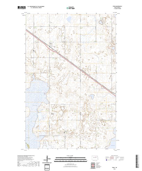
2024 Map of Penn
USGS Topo · Published 2024About this map
Penn sits as the primary settlement in this north-central North Dakota landscape, situated along the diagonal path of a major transit line and CO Hwy 2. This region of Ramsey County is defined by its complex glacial topography, where numerous wetlands and small water bodies punctuate the prairie. Larger water features such as Pelican Lake, Oswalds Bay, and Sixmile Bay dominate the western and southeastern corners of the map, illustrating the significant hydrological footprint that shapes local land use.
Find a feature on this map
31 named features on this map. Tap any name to fly to it.
Don’t see what you’re looking for? This feature index may not catch every label — zoom into the map to look around manually.
Map Details
Editions of this 2024 Penn Map
This is the sole edition of this map. No revisions or reprints were ever made.
Other maps of this area

1931 · Devils Lake
USGS Topo · 1:62,500

1932 · Grahams Island
USGS Topo · 1:62,500

1950 · Grahams Island
USGS Topo · 1:62,500

1950 · Devils Lake
USGS Topo · 1:62,500

1951 · Grahams Island
USGS Topo · 1:24,000

1951 · Tilden
USGS Topo · 1:24,000

1951 · Grand Harbor
USGS Topo · 1:24,000

1951 · Camp Grafton
USGS Topo · 1:24,000

1951 · Minnewaukan East
USGS Topo · 1:24,000

1951 · Penn
USGS Topo · 1:24,000