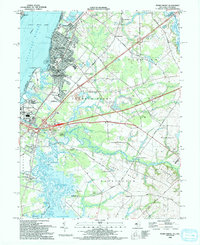
1993 Map of Penns Grove
USGS Topo · Published 1993About this map
The Delaware River defines the western edge of this 1993 study, where industrial and suburban developments like Penns Grove and Carneys Point meet the salt marshes and tidal flats of the New Jersey shore. The inland landscape transitions into the agricultural reaches of Oldmans and Pilesgrove, characterized by family-named crossroads like Raines Corner and Danceys Corner. Notable local landmarks include the Wilmington & Northern Branch railroad line and the Old Mans Airport, reflecting the region's transport evolution.
Find a feature on this map
70 named features on this map. Tap any name to fly to it.
Don’t see what you’re looking for? This feature index may not catch every label — zoom into the map to look around manually.
Map Details
Editions of this 1993 Penns Grove Map
This is the sole edition of this map. No revisions or reprints were ever made.
Other maps of this area

1890 · Salem
USGS Topo · 1:62,500

1894 · Chester
USGS Topo · 1:62,500

1896 · Chester
USGS Topo · 1:62,500

1898 · Salem
USGS Topo · 1:62,500

1898 · Chester
USGS Topo · 1:62,500

1901 · Camden
USGS Topo · 1:125,000

1901 · West Chester
USGS Topo · 1:62,500

1904 · West Chester
USGS Topo · 1:62,500

1904 · Wilmington
USGS Topo · 1:62,500

1906 · Wilmington
USGS Topo · 1:62,500