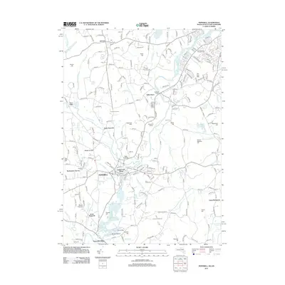
2012 Map of Pepperell
USGS Topo · Published 2012About this map
The Nashua River winds through the heart of this 2012 study, defining the boundary between New Hampshire and Massachusetts while anchoring historical industrial sites like Paper Mill Village and Burkinshaws Factory. The landscape is characterized by a dense network of residential growth integrated with agricultural heritage, evidenced by the presence of Kimball Fruit Farms and Autumn Hill Orchards. To the north, the town of Hollis serves as a primary hub, while the southern portion is dominated by the borough of Pepperell and the smaller cluster at Babbatasset Village. The importance of the river corridor is further highlighted by the preservation of The Ox Bow and numerous named hills such as Mount Lebanon and Drake Hill. Genealogists will find a high density of burial grounds throughout the area, from the East Cem and South Cem in the north to the Woodlawn Cem and Saint Josephs Cem closer to the central settlements.
Find a feature on this map
226 named features on this map. Tap any name to fly to it.
Don’t see what you’re looking for? This feature index may not catch every label — zoom into the map to look around manually.
Map Details
Editions of this 2012 Pepperell Map
This is the sole edition of this map. No revisions or reprints were ever made.
Other maps of this area

1886 · Lowell
USGS Topo · 1:62,500

1893 · Lowell
USGS Topo · 1:62,500

1893 · Groton
USGS Topo · 1:62,500

1905 · Manchester
USGS Topo · 1:62,500

1906 · Milford
USGS Topo · 1:62,500

1918 · Lowell
USGS Topo · 1:62,500

1921 · Lowell
USGS Topo · 1:62,500

1931 · Lowell
USGS Topo · 1:48,000

1931 · Groton
USGS Topo · 1:48,000

1935 · Ayer
USGS Topo · 1:24,000