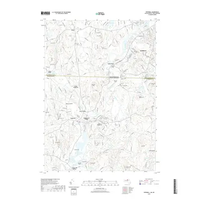
2018 Map of Pepperell
USGS Topo · Published 2018About this map
The Nashua River winds through this borderland where New Hampshire meets Massachusetts, connecting the mill traditions of Pepperell and East Pepperell with the northern outskirts of Nashua. The landscape is a mosaic of early settlements and family landmarks, from the clusters at Babbatasset Village and Hovey Corner to the riverside industrial legacy suggested by Paper Mill Village. High ground is defined by named peaks such as Shepley Hill and The Four Hills, while the valley floors are marked by the intricate hydrology of Unkety Brook, Reedy Meadow Brook, and the sweeping curve of The Ox Bow. For genealogists, the map is particularly detailed, locating numerous burial grounds including Woodlawn Cem, Blood Cem, and the Saint Louis De Gonzagues Cem. This modern survey documents the persistent boundary between Hillsborough Co and Middlesex Co, showing how contemporary residential growth and the Pepperell Airport have integrated into the region's older agricultural and riparian framework.
Find a feature on this map
227 named features on this map. Tap any name to fly to it.
Don’t see what you’re looking for? This feature index may not catch every label — zoom into the map to look around manually.
Map Details
Editions of this 2018 Pepperell Map
This is the sole edition of this map. No revisions or reprints were ever made.
Other maps of this area

1886 · Lowell
USGS Topo · 1:62,500

1893 · Lowell
USGS Topo · 1:62,500

1893 · Groton
USGS Topo · 1:62,500

1905 · Manchester
USGS Topo · 1:62,500

1906 · Milford
USGS Topo · 1:62,500

1918 · Lowell
USGS Topo · 1:62,500

1921 · Lowell
USGS Topo · 1:62,500

1931 · Lowell
USGS Topo · 1:48,000

1931 · Groton
USGS Topo · 1:48,000

1935 · Ayer
USGS Topo · 1:24,000