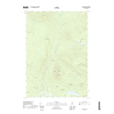
2018 Map of Percy Peaks
USGS Topo · Published 2018About this map
Percy Peaks dominates this landscape in Coos County, with its distinctive North Percy Peak and South Percy Peak summits rising above the surrounding timberland. This 2018 survey reveals a terrain defined by high-elevation water bodies and the drainage systems of the Upper Ammonoosuc River. The map shows a clear network of forestry and access roads like Nash Stream Rd and Trio Ponds Rd, which navigate the deep valleys and ridges of Stratford Mtn and Whitcomb Mtn.
Find a feature on this map
46 named features on this map. Tap any name to fly to it.
Don’t see what you’re looking for? This feature index may not catch every label — zoom into the map to look around manually.
Map Details
Editions of this 2018 Percy Peaks Map
This is the sole edition of this map. No revisions or reprints were ever made.
Other maps of this area

1920 · Guildhall
USGS Topo · 1:62,500

1929 · Averill
USGS Topo · 1:62,500

1930 · Percy
USGS Topo · 1:62,500

1930 · Dixville
USGS Topo · 1:62,500

1931 · Guildhall
USGS Topo · 1:48,000

1933 · Guildhall
USGS Topo · 1:48,000

1933 · Dixville
USGS Topo · 1:62,500

1934 · Percy
USGS Topo · 1:62,500

1934 · Dixville
USGS Topo · 1:62,500

1937 · Guildhall
USGS Topo · 1:62,500