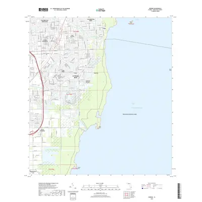
2018 Map of Perrine
USGS Topo · Published 2018About this map
Biscayne National Park borders the eastern edge of this coastal Florida landscape, where the waters of Biscayne Bay meet the Atlantic shore. The land is defined by an extensive network of drainage infrastructure, including the Cutler Drain Canal C-100 and its various branches, alongside the Princeton Canal Number C-102 to the south. These waterways carve through a dense suburban mosaic of established communities like Palmetto Bay, Cutler Bay, and West Perrine.
Find a feature on this map
130 named features on this map. Tap any name to fly to it.
Don’t see what you’re looking for? This feature index may not catch every label — zoom into the map to look around manually.
Map Details
Editions of this 2018 Perrine Map
This is the sole edition of this map. No revisions or reprints were ever made.
Other maps of this area

1947 · Key Biscayne
USGS Topo · 1:24,000

1948 · Soldier Key
USGS Topo · 1:24,000

1949 · South Miami NW
USGS Topo · 1:24,000

1949 · Elliott Key
USGS Topo · 1:24,000

1949 · Key Biscayne
USGS Topo · 1:24,000

1949 · Arsenicker Keys
USGS Topo · 1:24,000

1949 · Goulds
USGS Topo · 1:24,000

1949 · Perrine
USGS Topo · 1:24,000

1950 · Homestead
USGS Topo · 1:24,000

1950 · South Miami
USGS Topo · 1:24,000