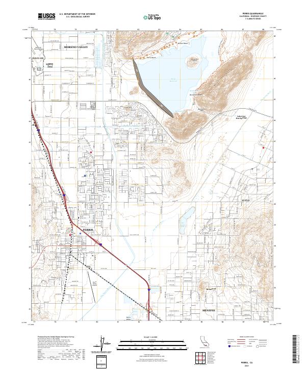
2021 Map of Perris
USGS Topo · Published 2021About this map
Perris and the surrounding Riverside County basin appear here in a landscape defined by sophisticated water infrastructure and suburban expansion. The Perris Reservoir dominates the northeastern corner, with Alessandro Island and Bernasconi Beach serving as prominent recreational landmarks. The engineering of the region is visible in the path of the Colorado River Aqueduct and the Perris Valley Storm Drain, which cut through the valley floor to manage the resources of this arid corridor.
Find a feature on this map
122 named features on this map. Tap any name to fly to it.
Don’t see what you’re looking for? This feature index may not catch every label — zoom into the map to look around manually.
Map Details
Editions of this 2021 Perris Map
This is the sole edition of this map. No revisions or reprints were ever made.
Historical Maps of Vicenza Through Time
5 maps found