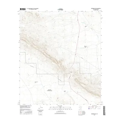
2016 Map of Persimmon Gap
USGS Topo · Published 2016About this map
Big Bend National Park serves as the focal point for this section of Brewster County, where the gateway at Persimmon Gap marks a transition through the mountain ridges. The geography is defined by a network of ephemeral watercourses including Maravillas Cr, Javelina Draw, and Santiago Draw, which carve through the arid terrain. Human infrastructure is concentrated along Main Park Rd, providing access to the park's interior from the north. Outside the park boundary, the landscape contains evidence of local aviation and ranching heritage, such as the Persimmon Gap Ranch Airport and water management features like Carney Tank. Transportation routes like Ranch Rd 2627 and Chalk Draw Ranch Rd follow the natural topography, illustrating how modern roads adhere to historical passage points between the northern draws and the protected parklands to the south.
Find a feature on this map
11 named features on this map. Tap any name to fly to it.
Don’t see what you’re looking for? This feature index may not catch every label — zoom into the map to look around manually.
Map Details
Editions of this 2016 Persimmon Gap Map
This is the sole edition of this map. No revisions or reprints were ever made.
Other maps of this area

1917 · Santiago Peak
USGS Topo · 1:62,500

1917 · Bone Spring
USGS Topo · 1:62,500

1917 · Hood Spring
USGS Topo · 1:62,500

1918 · Bone Spring
USGS Topo · 1:125,000

1918 · Hood Spring
USGS Topo · 1:62,500

1918 · Santiago Peak
USGS Topo · 1:62,500

1918 · Bone Spring
USGS Topo · 1:62,500

1918 · Nine Point Mesa
USGS Topo · 1:62,500

1920 · Bone Spring
USGS Topo · 1:62,500

1931 · Hood Spring
USGS Topo · 1:62,500