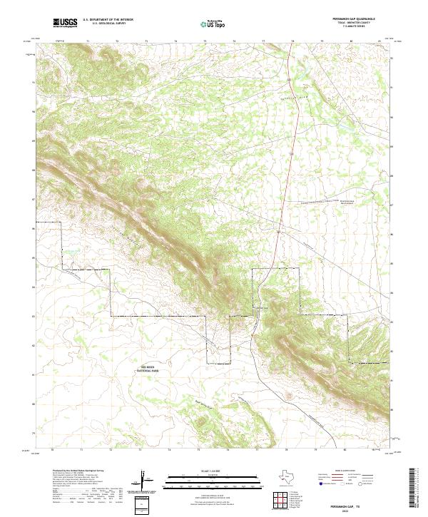
2022 Map of Persimmon Gap
USGS Topo · Published 2022About this map
Big Bend National Park occupies the southern reaches of this Brewster County landscape, where the Santiago Mountains create a formidable natural barrier. The topography is defined by the eponymous Persimmon Gap, a critical mountain pass that has long served as a gateway into the desert interior. This breach in the range provides the primary passage for Persimmon Gap Road, which follows the natural contour of the land alongside ephemeral drainage systems.
Find a feature on this map
12 named features on this map. Tap any name to fly to it.
Don’t see what you’re looking for? This feature index may not catch every label — zoom into the map to look around manually.
Map Details
Editions of this 2022 Persimmon Gap Map
This is the sole edition of this map. No revisions or reprints were ever made.
Other maps of this area

1917 · Santiago Peak
USGS Topo · 1:62,500

1917 · Bone Spring
USGS Topo · 1:62,500

1917 · Hood Spring
USGS Topo · 1:62,500

1918 · Bone Spring
USGS Topo · 1:125,000

1918 · Hood Spring
USGS Topo · 1:62,500

1918 · Santiago Peak
USGS Topo · 1:62,500

1918 · Bone Spring
USGS Topo · 1:62,500

1918 · Nine Point Mesa
USGS Topo · 1:62,500

1920 · Bone Spring
USGS Topo · 1:62,500

1931 · Hood Spring
USGS Topo · 1:62,500