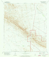
1971 Map of Persimmon Gap
USGS Topo · Published 1973About this map
Big Bend National Park serves as the focal point for this 1970s survey, marking the northern gateway to this Chihuahuan Desert landscape. The boundary of the park is clearly delineated as it cuts across the southern portion of the sheet, encompassing the Persimmon Gap Ranger Station and the topographic bottleneck of Persimmon Gap. This passage through the Santiago Mountains has historically been a vital corridor for travel through the region's arid terrain.
Find a feature on this map
15 named features on this map. Tap any name to fly to it.
Don’t see what you’re looking for? This feature index may not catch every label — zoom into the map to look around manually.
Map Details
Editions of this 1971 Persimmon Gap Map
This is the sole edition of this map. No revisions or reprints were ever made.
Other maps of this area

1917 · Santiago Peak
USGS Topo · 1:62,500

1917 · Bone Spring
USGS Topo · 1:62,500

1917 · Hood Spring
USGS Topo · 1:62,500

1918 · Bone Spring
USGS Topo · 1:125,000

1918 · Hood Spring
USGS Topo · 1:62,500

1918 · Santiago Peak
USGS Topo · 1:62,500

1918 · Bone Spring
USGS Topo · 1:62,500

1918 · Nine Point Mesa
USGS Topo · 1:62,500

1920 · Bone Spring
USGS Topo · 1:62,500

1931 · Hood Spring
USGS Topo · 1:62,500