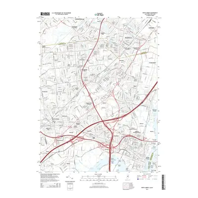
2014 Map of Perth Amboy
USGS Topo · Published 2014About this map
Rahway and Linden anchor the northern reaches of this detailed survey, where the industrial and residential landscapes of northern New Jersey meet the complex waterways of the Arthur Kill. The map documents a dense network of suburban developments like Lynn Woodoaks and Woodbridge Oaks alongside established town centers such as Metuchen. A heavy concentration of memorial sites, including the Metuchen Colonial Cem and Beth Israel Memorial Park, provides significant data for genealogical research. The southern portion of the sheet is dominated by the industrial shipping channels of the Raritan River, featuring specialized zones like Red Root Reach and Keasbey Reach. This corridor is defined by massive infrastructure, including the Thomas A Edison Bridge and the Outerbridge Crossing, which facilitate the heavy transit and commerce of the New York-New Jersey borderlands.
Find a feature on this map
93 named features on this map. Tap any name to fly to it.
Don’t see what you’re looking for? This feature index may not catch every label — zoom into the map to look around manually.
Map Details
Editions of this 2014 Perth Amboy Map
This is the sole edition of this map. No revisions or reprints were ever made.
Other maps of this area

1888 · Plainfield
USGS Topo · 1:62,500

1888 · New Brunswick
USGS Topo · 1:62,500

1888 · Sandy Hook
USGS Topo · 1:62,500

1893 · New Brunswick
USGS Topo · 1:62,500

1893 · Plainfield
USGS Topo · 1:62,500

1893 · Sandy Hook
USGS Topo · 1:62,500

1898 · Plainfield
USGS Topo · 1:62,500

1898 · Staten Island
USGS Topo · 1:62,500

1900 · Passaic
USGS Topo · 1:125,000

1900 · Staten Island
USGS Topo · 1:62,500