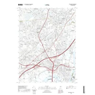
2019 Map of Perth Amboy
USGS Topo · Published 2019About this map
Perth Amboy and the surrounding industrial corridor of Middlesex Co stand at a vital crossroads where the Raritan River meets the Arthur Kill. The landscape is defined by dense residential neighborhoods such as Fords, Metuchen, and Sewaren intertwined with heavy logistics and maritime infrastructure. The map documents an area with deep genealogical roots, visible in the high density of historic burial grounds including Rahway Cem and specialized religious sites like the Ukrainian Catholic Church of the Assumption Cem.
Find a feature on this map
107 named features on this map. Tap any name to fly to it.
Don’t see what you’re looking for? This feature index may not catch every label — zoom into the map to look around manually.
Map Details
Editions of this 2019 Perth Amboy Map
This is the sole edition of this map. No revisions or reprints were ever made.
Other maps of this area

1888 · Plainfield
USGS Topo · 1:62,500

1888 · New Brunswick
USGS Topo · 1:62,500

1888 · Sandy Hook
USGS Topo · 1:62,500

1893 · New Brunswick
USGS Topo · 1:62,500

1893 · Plainfield
USGS Topo · 1:62,500

1893 · Sandy Hook
USGS Topo · 1:62,500

1898 · Plainfield
USGS Topo · 1:62,500

1898 · Staten Island
USGS Topo · 1:62,500

1900 · Passaic
USGS Topo · 1:125,000

1900 · Staten Island
USGS Topo · 1:62,500