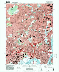
1995 Map of Perth Amboy
USGS Topo · Published 2000About this map
Industrial corridors and dense suburban developments characterize this mid-1990s landscape at the confluence of the Raritan River and Arthur Kill. The map highlights a complex transit network where the Garden State Parkway and New Jersey Turnpike converge near the Outerbridge Crossing Bridge, facilitating movement between Metuchen, Woodbridge, and Perth Amboy. Significant landmarks of civic and local history are prominent, including the Edison Memorial Tower in Menlo Park and the large State Prison complex near Hazelton. This area showcases the transition from heavy industry, represented by numerous petroleum storage sites and the Raritan Center, to established residential neighborhoods and cemeteries such as Beth Israel and Hazelwood Cemetery. Extensive green spaces like Ash Brook Swamp Reservation and Roosevelt County Park provide a notable contrast to the surrounding urban fabric.
Find a feature on this map
126 named features on this map. Tap any name to fly to it.
Don’t see what you’re looking for? This feature index may not catch every label — zoom into the map to look around manually.
Map Details
Editions of this 1995 Perth Amboy Map
This is the sole edition of this map. No revisions or reprints were ever made.
Other maps of this area

1888 · Plainfield
USGS Topo · 1:62,500

1888 · New Brunswick
USGS Topo · 1:62,500

1888 · Sandy Hook
USGS Topo · 1:62,500

1893 · New Brunswick
USGS Topo · 1:62,500

1893 · Plainfield
USGS Topo · 1:62,500

1893 · Sandy Hook
USGS Topo · 1:62,500

1898 · Plainfield
USGS Topo · 1:62,500

1898 · Staten Island
USGS Topo · 1:62,500

1900 · Passaic
USGS Topo · 1:125,000

1900 · Staten Island
USGS Topo · 1:62,500