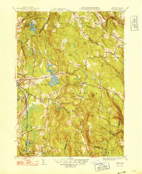
1948 Map of Peru
USGS Topo · Published 1948About this map
Ashmere Lake and Plunkett Res define the central water landscape of this Berkshire County study, which highlights a network of small settlements and mountain topography. The high ground of the Hoosac Range is marked by prominent peaks such as Garnet Hill, Peru Hill, and French Hill, while the Housatonic River and the Boston and Albany railroad corridor facilitate movement through the western valley near Hinsdale.
Find a feature on this map
100 named features on this map. Tap any name to fly to it.
Don’t see what you’re looking for? This feature index may not catch every label — zoom into the map to look around manually.
Map Details
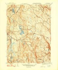
Editions of this 1948 Peru Map
2 editions found
Other maps of this area

1886 · Greylock
USGS Topo · 1:62,500

1886 · Hawley
USGS Topo · 1:62,500

1886 · Chesterfield
USGS Topo · 1:62,500

1886 · Becket
USGS Topo · 1:62,500

1888 · Becket
USGS Topo · 1:62,500

1888 · Chesterfield
USGS Topo · 1:62,500

1890 · Hawley
USGS Topo · 1:62,500

1891 · Greylock
USGS Topo · 1:62,500

1893 · Chesterfield
USGS Topo · 1:62,500

1893 · Becket
USGS Topo · 1:62,500